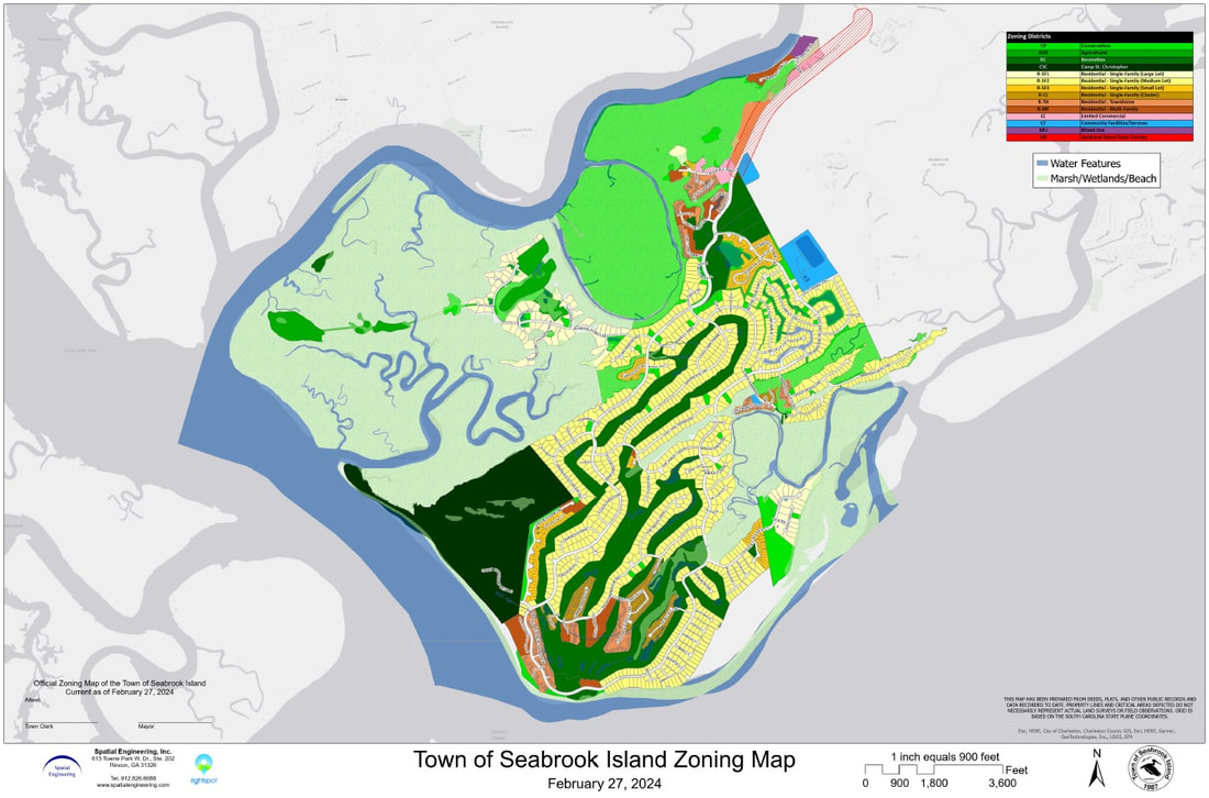
Zoning Map
|
The official zoning map of the town designates the location and boundaries of the various districts established by the Development Standards Ordinance (DSO). The official zoning map is kept on file in the office of the Zoning Administrator and is available for public inspection during regular business hours. A digital copy of the map may be viewed and/or downloaded below.
The official zoning map, together with any amendments approved by Town Council but not yet incorporated into the map, shall serve as the final authority regarding the current zoning district classification of all land within the town. Official Zoning MapMap Amendments adopted by Town Council but not yet reflected in the official zoning map:
Map Amendments (Rezoning)The official zoning map may be amended from time to time upon request by any property owner, or by Town Council, either on its own initiative or upon recommendation by the Planning Commission or the Zoning Administrator. In each case, the procedures for amending the official zoning map shall be as provided in Section 19.2 of the Development Standards Ordinance.
Any property owner who seeks to amend the zoning designation of his or her property shall file a written application with the Zoning Administrator. Only competes applications containing all required information, exhibits, and the required application fee, shall be processed in accordance with the public notice and hearing requirements of the DSO. For assistance in filing an application for rezoning, please contact Tyler Newman, Zoning Administrator, by phone at (843) 768-9121 or by email at [email protected]. |
Contact |

