|
In conjunction with curfews issued by the City of Charleston and the City of North Charleston, Charleston County Council has issued a countywide curfew from 6:00 pm on Sunday, May 31st, until 6:00 am on Monday, June 1st. The Town of Seabrook Island is located within Charleston County and is subject to this curfew.
A curfew requires people to stay indoors during the hours of the curfew; however, employees are permitted to travel to and from their places of employment. Residents and visitors of Seabrook Island are advised to stay indoors between 6:00 pm and 6:00 am to avoid violating the countywide curfew. Businesses may prefer to close so as not to encourage the public to be travelling to and from their places of business. For more information, please visit the Charleston County website. Property owners and managers with rental guests should forward this information to their rental guests. Owners and managers of commercial establishments within the town are also encouraged to share this information with their employees. The National Hurricane Center issued the following bulletin regarding Tropical Storm Bertha at 8:30 AM on Wednesday, May 27, 2020:
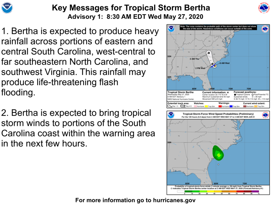
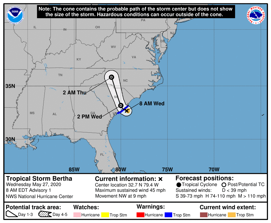
TROPICAL STORM BERTHA FORMS NEAR THE COAST OF SOUTH CAROLINA TROPICAL STORM WARNING ISSUED AND HEAVY RAINFALL EXPECTED SUMMARY OF 8:30 AM EDT INFORMATION
WATCHES AND WARNINGS A Tropical Storm Warning is in effect for the coast of South Carolina from Edisto Beach to South Santee River. A Tropical Storm Warning means that tropical storm conditions are expected somewhere within the warning, in this case in the next few hours. For storm information specific to your area, including possible inland watches and warnings, please monitor products issued by your local National Weather Service forecast office. DISCUSSION AND OUTLOOK At 8:30 AM EDT, the center of Tropical Storm Bertha was located near latitude 32.7 North, longitude 79.4 West. Bertha is moving toward the northwest near 9 mph (15 km/h) and this motion is expected to continue through tonight. On the forecast track the center of Bertha will move onshore in the warning area in the next few hours and the move inland across eastern and northern South Carolina later today and into west-central North Carolina by tonight. Maximum sustained winds are near 45 mph (75 km/h) with higher gusts. Bertha is expected to weaken to a tropical depression after moving inland and become a remnant low tonight. Tropical-storm-force winds extend outward up to 25 miles (35 km) from the center. The estimated minimum central pressure is 1009 mb (29.80 inches). HAZARDS AFFECTING LAND RAINFALL: Bertha is expected to produce total rain accumulation of 2 to 4 inches with isolated totals of 8 inches across eastern and central South Carolina into west central to far southeastern North Carolina and southwest Virginia. This rainfall may produce life-threatening flash flooding. WIND: Tropical storm conditions are expected to reach the coast within the warning area in the next couple of hours. For more information, please visit the National Hurricane Center website. Property owners and managers with rental guests should forward this information to their rental guests. |
Archives
January 2024
Categories
All
|
- About
-
Government
-
Meetings
-
Agendas & Minutes
>
- Town Council
- ATAX Advisory Committee
- Board of Zoning Appeals
- Community Promotion & Engagement Committee
- Environment & Wildlife Committee
- Planning Commission
- Public Safety Committee
- Public Works Committee
- Special Committee on ARPA Expenditures
- Special Committee on Finance
- Special Committee on Short-Term Rentals
- Utility Commission
- Public Comments >
- Short-Term Rental Study >
-
Agendas & Minutes
>
-
Services
- News & Events
- Links
- Contact
|
Town of Seabrook Island
2001 Seabrook Island Road Seabrook Island, SC 29455 Phone: (843) 768-9121 Email: [email protected] Town Hall Hours: M-F 8:00 am to 4:00 pm Privacy Policy |
|


 RSS Feed
